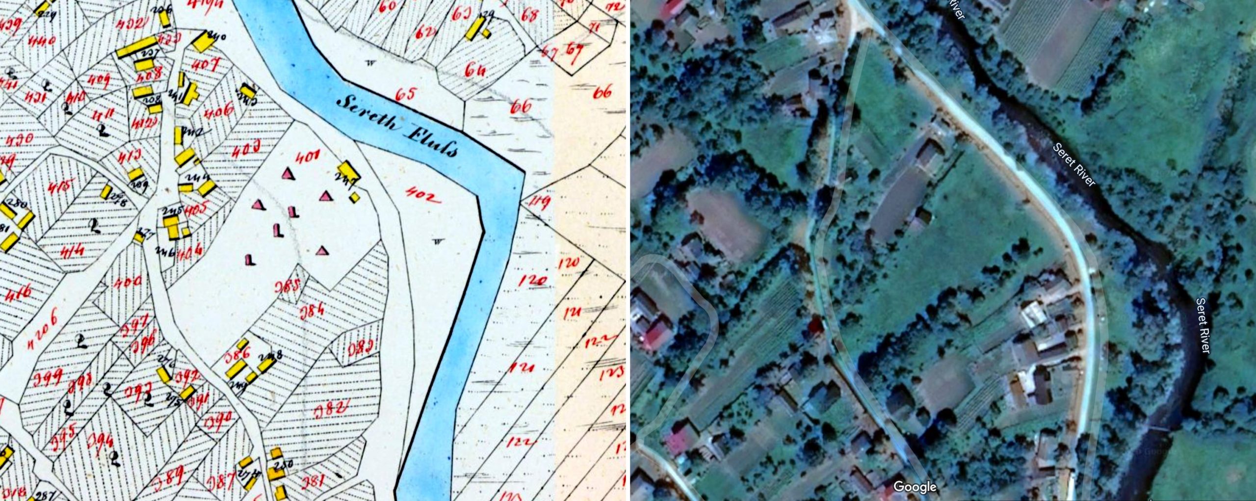
The Jewish cemetery of Zaliztsi on an 1850 cadastral map and on a modern satellite image. Map courtesy of TsDIAL and Gesher Galicia; satellite imagery © CNES/Airbus, Maxar Technologies, and Google.
The Jewish cemetery of Zaliztsi on an 1850 cadastral map and on a modern satellite image