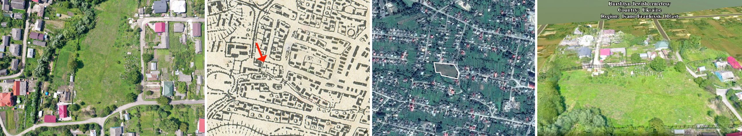
Survey images from the ESJF database page for the Jewish cemetery in Burshtyn . Left to right: drone photo from above the site; historical map (red arrow indicates the cemetery); Google Maps satellite image with cemetery outlined by ESJF; model of a proposed visualized in 3D.
Survey images from the Jewish cemetery in Burshtyn