![]() Ця сторінка також доступна українською.
Ця сторінка також доступна українською.
Introduction

The information sign at the Jewish cemetery, and its placement adjacent to the gate. Photos © RJH.
This page summarizes and analyzes a recent project which installed information and access signs at the Jewish cemetery of Bolekhiv in the Bolekhiv raion of the Ivano-Frankivsk oblast in western Ukraine, at a Jewish wartime mass grave in a forest outside of Bolekhiv, and at other Holocaust history sites in the town. This project was coordinated directly and indirectly with several other projects managed by the same organization and by other individuals and organizations, at the same site and other sites in western Ukraine. This page shares information with the related case study 06 active at the same sites.
This page is intended as a reference for similar projects now in the planning stages in western Ukraine or beyond. Following a brief summary of the site, the material below describes the project and reviews its effectiveness together with a listing of issues encountered, approximate project costs, and ongoing risks. Related projects both in western Ukraine and elsewhere in Europe are also briefly mentioned, for comparison. At the bottom of this page are links to project documentation and to additional reference information about the burial site and related projects.
Read the overview to case studies of selected projects at Jewish burial sites in western Ukraine.
Project Summary
The mass grave monument in a forest clearing outside Bolekhiv. Photo © RJH.
Project type: Design and installation of information signage at the entrance to the Jewish cemetery of Bolekhiv, at a Jewish mass grave outside of the town, and at other Holocaust history sites in Bolekhiv.
Location and site type: Jewish cemetery of Bolekhiv, Bolekhiv raion, Ivano-Frankivsk oblast, Ukraine. GPS: 49.05736, 23.85710. Jewish wartime mass grave northwest of Bolekhiv, Bolekhiv raion, Ivano-Frankivsk oblast, Ukraine, in the forest between Bolekhiv and the village of Taniava. GPS: 49.08599, 23.82695.
Description of the site: The mass grave extends to unknown dimensions on flat ground in a forest clearing approximately 175m from vul. Sichovykh Striltsiv, about 3.5km northwest of the town center. The cemetery perimeter is an irregular shape of approximately 580m length, enclosing roughly 1.8 hectare of area, on a hilltop site with moderate slope.
Ownership and stakeholders: Ownership of the mass grave site is unknown, likely the municipality of Bolekhiv or the Dolyna raion administration. Legal ownership of the cemetery site is unknown, presumed defaulted to the municipality of Bolekhiv. Stakeholders include the Bolechow Jewish Heritage Society, adjacent landowners and the local civil community, foreign descendants of Bolekhiv’s pre-war Jewish and other families, historians, and students of Jewish culture.
Official heritage status: Unknown.
Activists working on/at the site: Bolechow Jewish Heritage Society (BJHS), a registered US 501(c)(3) non-profit organization founded in 2007 and based in Bethesda, Maryland, US. Contact info. See also the BJHS Facebook page.
Other projects active at the site: See case study 06 for a description of a vegetation clearing project at both sites. Directional signage in the town of Bolekhiv to the cemetery, and contact information for access to the cemetery outside a private property. Construction of a rectangular concrete surround and memorial marker at the mass grave site (unknown builders, unknown date). Mass grave research and documentation at the cemetery site (see Yahad – In Unum 2013 research summary). Commemorative event at the mass grave site with Bolekhiv Jewish descendants, a witness, local government and religious leaders (see BJHS 2009 ceremony page).
Project Analysis
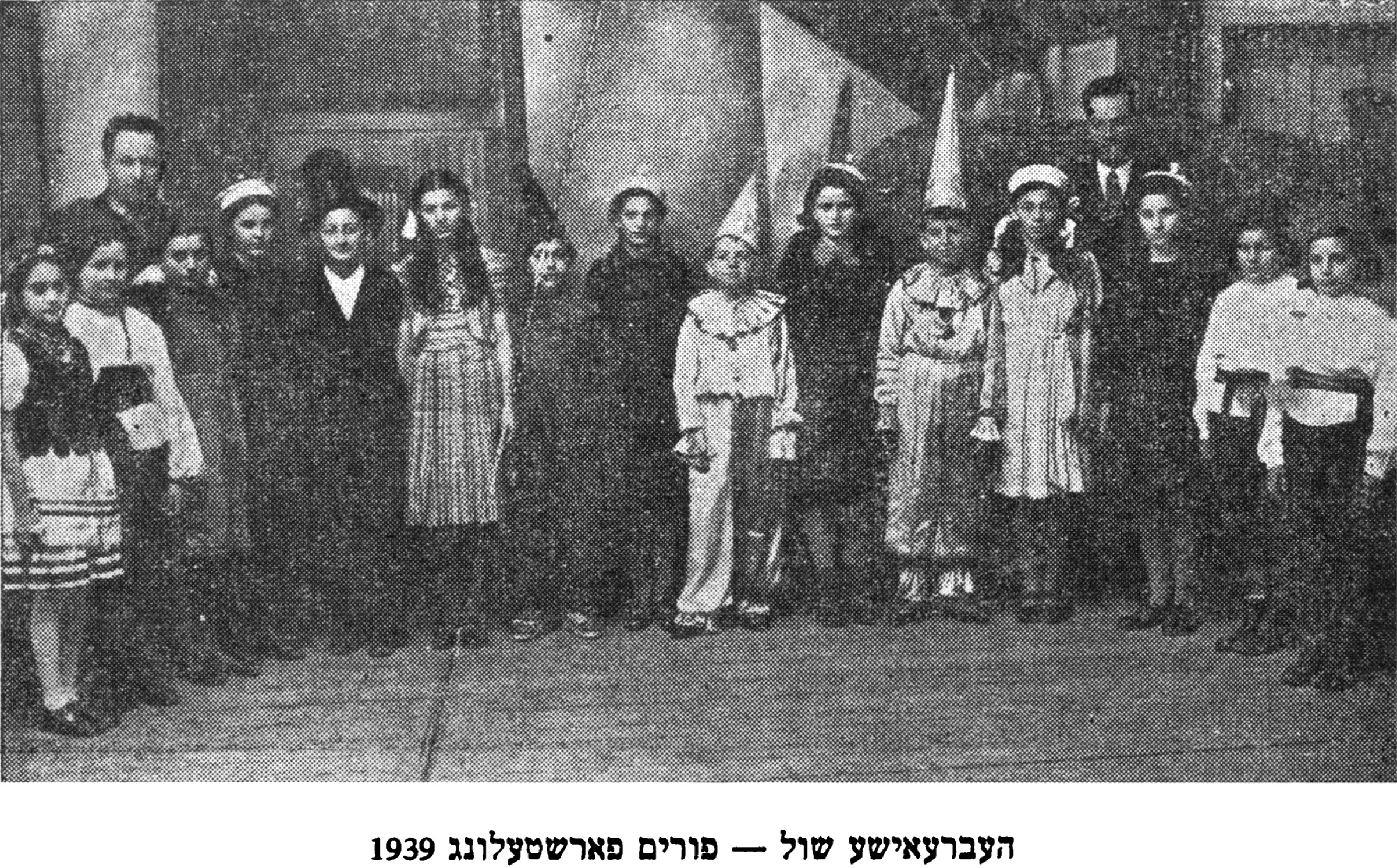
Bolekhiv Hebrew school Purim presentation, 1939. From the Bolekhiv Yizkor book, p.300.
History of the sites: See case study 06 for a history of the Jewish community and the cemetery.
In the Yizkor Book for Bolekhiv, Josef Adler reports that after the murder of 20 Jews under the Great Bridge of Bolekhiv in July 1941 by armed militia, the rest of summer 1941 saw few killings. During the morning of 28 October 1941, hundreds of Jewish men, and in the afternoon women and children, were arrested, robbed, and imprisoned in the former “DKA” (Red Army House) of Bolekhiv, where they were tortured; more than two dozen Jews died from beatings and executions, and from suffocation in the crammed building during the rest of the day and the night; these dead were later buried in a common grave in the Bolekhiv Jewish cemetery. The following morning, more arrested Jews were packed into the DKA building, and then the group was marched and trucked to the forest site near the road to Taniava village, where a pit had been dug to serve as a mass grave. Adler reports that between 850 and 1000 Jews were shot to death by six machine guns and buried there, with a few escapees before the shooting and a single survivor of the mass killings.
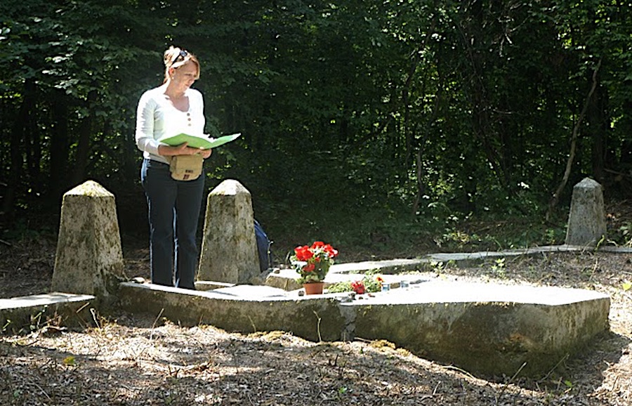
Jewish descendant Bracha Altervits reading at the mass grave commemoration in 2009. Photo © BJHS.
At an unknown date perhaps not long after the war, during the period of Soviet rule in Ukraine, a plain monument was built at the mass grave site en route to Taniava village, including a concrete surround and a memorial plaque to Soviet citizens as victims of Fascism, i.e. without mention of the ethnic selection which preceded the killings. According to Adler, by 2003 the grave site had decayed, and the plaque had disappeared.
The non-profit Bolechow Jewish Heritage Society (BJHS) was formed in 2007 by Jewish descendants and interested others with the aim of protecting and commemorating the cemetery, the forest mass grave, and other Jewish heritage sites in Bolekhiv. See case study 06 for an overview of their related vegetation clearing and maintenance work at the both burial sites.
In 2013, the French non-profit organization Yahad – in Unum conducted interviews and other research into the killings and mass burials in Bolekhiv as part of a broader investigation into wartime crimes and the burial sites of the victims. That research confirmed four killing sites in and around Bolekhiv, including in the cemetery and at the Taniava forest site. Research, interviews, and meetings by Yahad – In Unum in and near Bolekhiv continued in 2020.
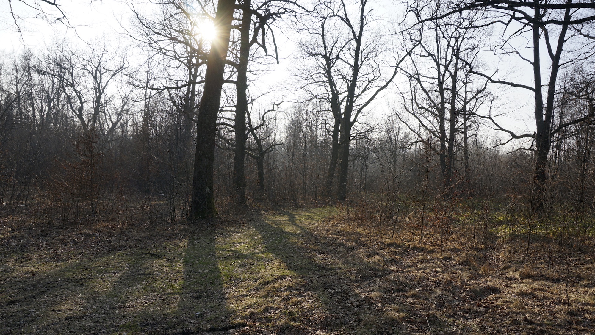
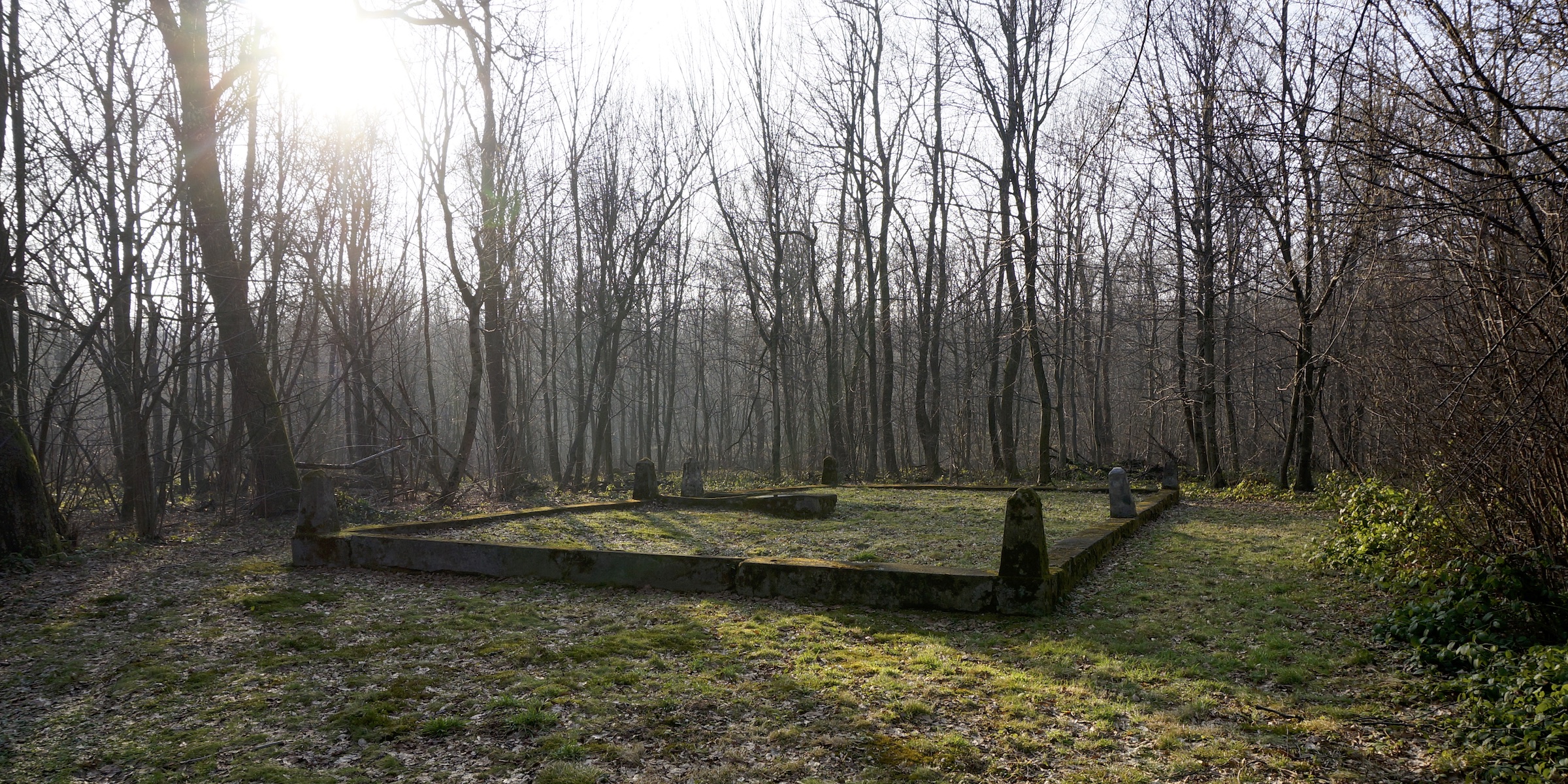
The path through the trees to the mass grave site. Photo © RJH.
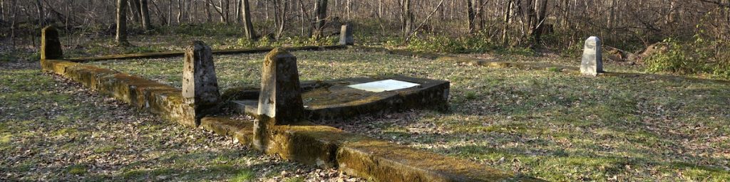
Current features of/at the site: See case study 06 for a description of the cemetery site. The mass grave site is located in the forest between Bolekhiv and the village of Taniava, at a spot about 3.5km northwest of Bolekhiv town center near vul. Sichovykh Striltsiv. Access to the site from the road is via an unmarked path from the road through trees and shrubs, about 175m on foot or by small vehicle to a clearing in the trees. The clearing is visible in some modern satellite views (e.g. Google or Bing Maps), and during a visit in early 2020 the burial grounds were seen to be clean and clear of tall shrubs. The identified grave area is bounded by a Soviet-era monument in the form of a rectangular concrete curb roughly 6m by 9m, with pyramidal concrete pylons at the corners and at the marker border. The curb and pylon structure is intact but superficially decayed since its installation. A concrete platform which once held a Soviet plaque or other flat marker at one side of the curb surround has partially collapsed; it now holds the site information sign installed by BJHS.
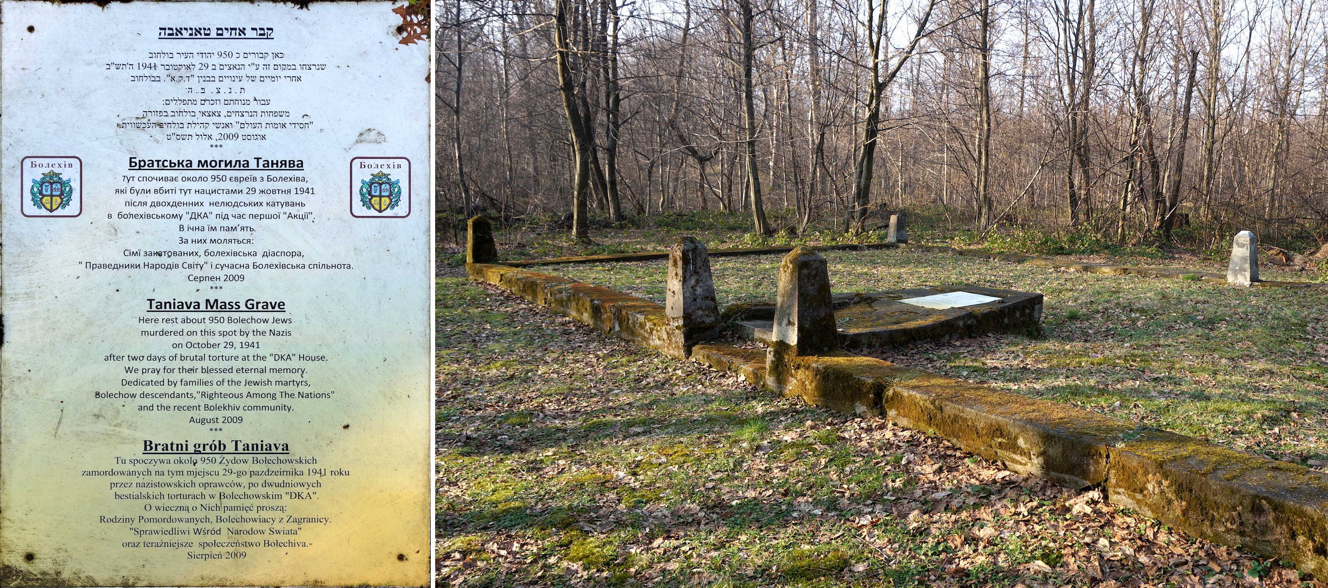
The information sign at the Jewish mass grave in the forest, and its placement adjacent on the old monument. Photos © RJH.
Details of the project: Signs to explain the history of the Jewish burial sites in and near Bolekhiv were developed as part of plans for a commemoration held in Bolekhiv by BJHS in 2009. The text for the signs was developed by the BJHS board of directors; fabrication of the signs and their transport to Bolekhiv was arranged by a survivor living in Israel; installation at the sites was achieved by that survivor and by the descendants of the family in Bolekhiv who had sheltered him during the Holocaust. Four signs were created and installed: first, at the gate entrance to the cemetery, to identify the wall as the boundary of the cemetery, give the year the cemetery was established, and explain that there are also wartime mass graves within the cemetery perimeter; second, within the cemetery at the location of the largest of the mass graves there, to mark and explain that history; third, affixed to the mass grave monument in the forest near Taniava, to explain who is buried there and the circumstances of their murder; and fourth, on an exterior wall of the former “DKA” (Red Army House) building, later an oblast civil registration office, to mark the site north of the town center where over a thousand Jews were gathered and tortured before their murder in the forest. Each of the information signs includes the same text in Hebrew, Ukrainian, and English; the signs at the forest mass grave and former DKA building also include the same text in Polish, the secular language of the Jewish victims.
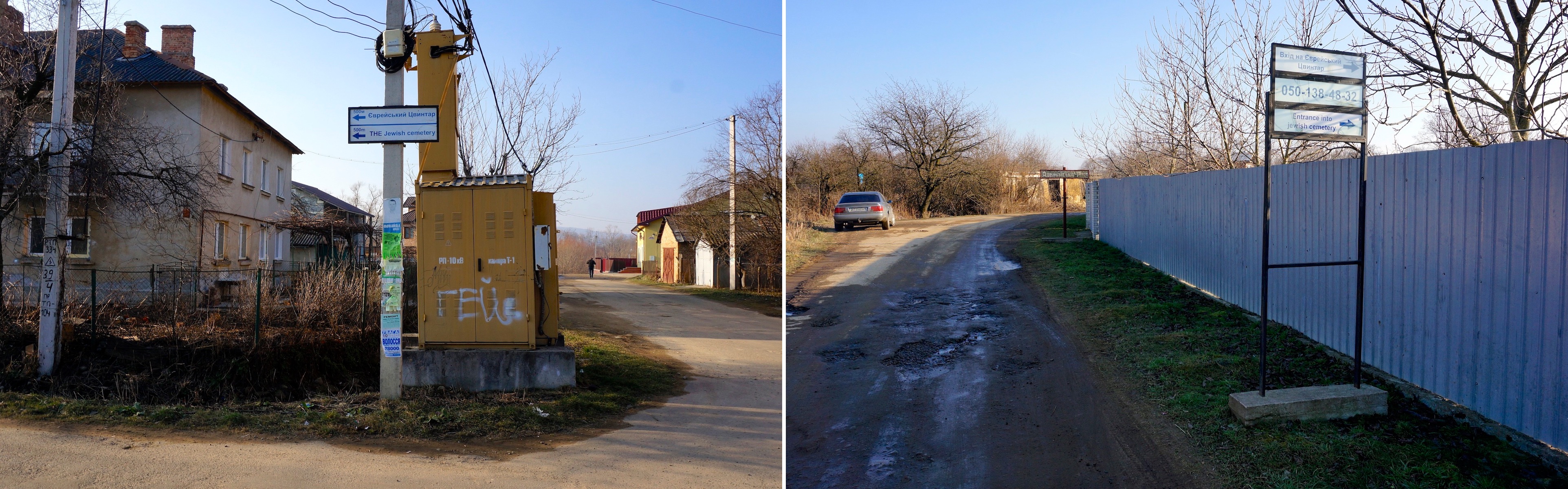
Signs on Bolekhiv streets directing visitors to the Jewish cemetery. Photos © RJH.
In addition to the information signs, BJHS also arranged for a sign outside the private property which abuts the cemetery and its gate; the sign gives the contact phone number for the property owner for visitors to use when they wish to access the cemetery. This sign, which was created locally in Bolekhiv, aims to address the issue created when the original public access road to the cemetery was closed off by walls around neighboring yards.
In a separate project probably implemented on the initiative of the Bolekhiv town administration around the time of the 2009 commemoration event, a directional sign pointing to the Jewish cemetery was affixed to a power pole on a street near the town center, with directions in both Ukrainian and English.
Issues encountered in the project: None.
Project costs, one-time and sustaining: The cost of fabricating the information signs was not recorded by BJHS, but was likely very small. All of the labor for texts, translations, design, and installation was donated. There are no recurring costs, although BJHS anticipates that gradual weathering of the signs will require their replacement someday.

The information sign on the former DKA building, and its placement near the entrance. Photos © BJHS.
Current risks to preservation: Since their original installation at the cemetery and the mass grave site in 2009, the information signs have decayed only slightly, including some fading of the background color of the signs, some superficial scratches, and a small amount of dirt and mildew attached to the face of the signs. The screws which attach the signs to the concrete at both sites have corroded but appear solid as of 2020. It seems reasonable to expect that so long as the signs remain attached to their structures, they should continue to serve their purpose for another decade or more.
Since the 2009 commemoration, the former DKA building has been torn down, erasing the historical torture site and its memorial sign.
The directional signs which point to the Jewish cemetery from the town center of Bolekhiv and at the street entrance to the cemetery site appear robust and of durable materials, showing age and some water damage but no structural decay. Attachment of the signs to their supports is solid and could easily be renewed locally if the need arises.
Absent rehabilitation of the Taniava forest mass grave site and its memorial structures, the concrete of the original Soviet monument can be expected to continue its gradual decay for the next decades; no other risks are apparent. See case study 06 for additional discussion about the preservation status of the Bolekhiv Jewish cemetery.
Scenes from the cemetery ceremony in 2009 with Bolekhiv city officials, members of BJHS, Jewish descendants and Holocaust survivors of Bolekhiv. Images © BJHS.
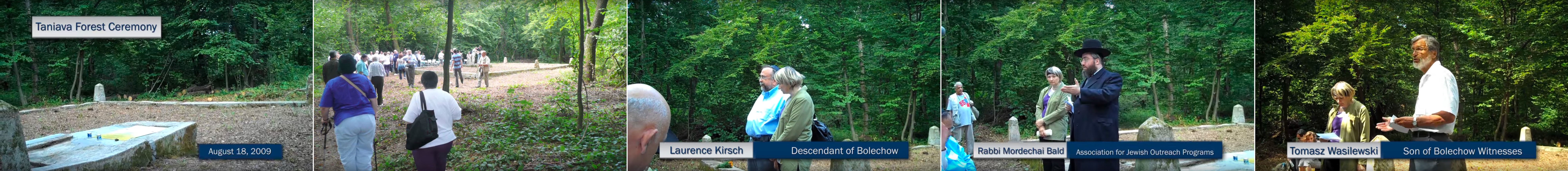
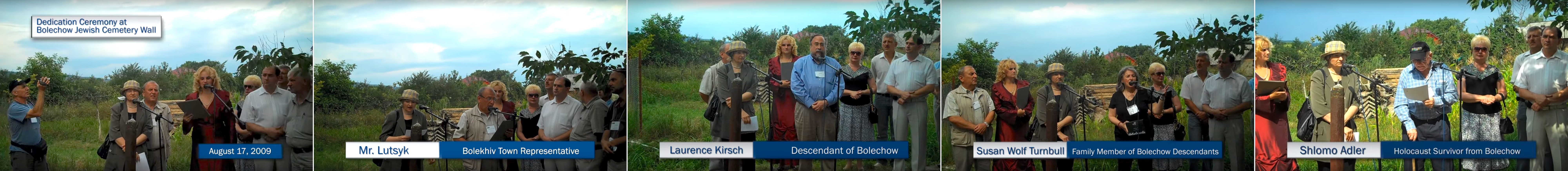
Scenes from the mass grave ceremony in 2009 with religious and civil officials, Holocaust survivors, Jewish and other descendants of Bolekhiv. Images © BJHS.
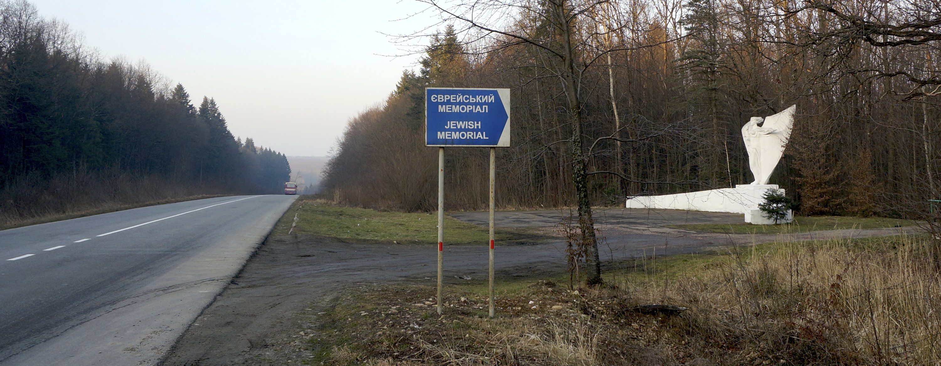
Directional signage to the mass grave area northwest of Drohobych. Photo © RJH.
Related projects in western Ukraine: Information signage for and directional signage to Jewish burial sites are rare in western Ukraine. In addition to the Jewish cemetery of Bolekhiv, another example of directional signage is at the mass grave area northwest of Drohobych (Lviv oblast), between the villages of Lishnia and Bronytsia; there, road signs in both directions on the main highway between Drohobych and Sambir alerts passersby to the location of the site, and additional signs on the footpath from the road guide visitors to the graves deep in the forest and provide some information about families lost in the Holocaust. In early 2021, the city administration in Rohatyn (Ivano-Frankivsk oblast) installed nine bilingual pedestrian signposts around the city center, each with three or more signs pointing to cultural heritage sights; the Jewish cemeteries and mass graves in the city were included in these sets along with tourist services (museums, hotels, cafes) as well as memorials, historic churches, and the city council offices.
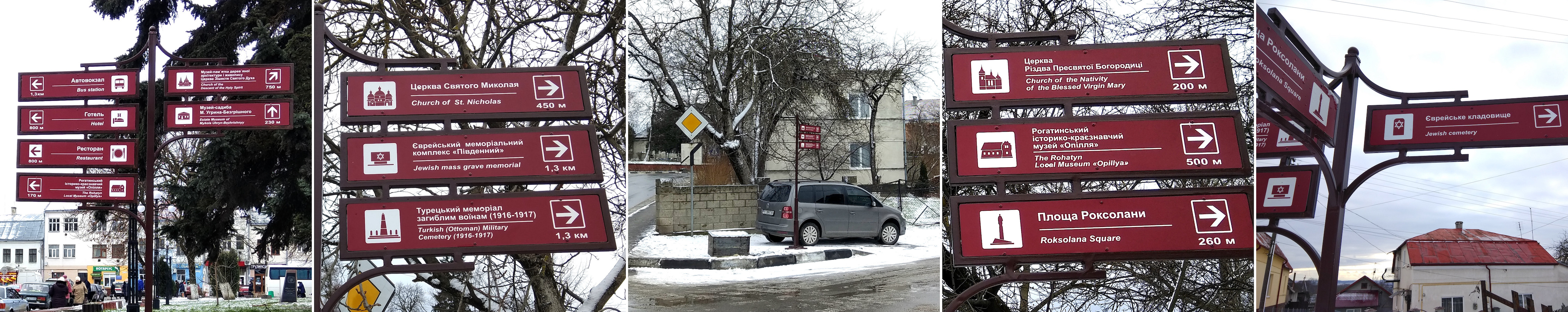
Examples of directional pedestrian signs around the center of Rohatyn, including arrows to Jewish heritage sites. Photos © RJH.
ESJF European Jewish Cemeteries Initiative often installs signage at least identifying cemetery sites, in multiple languages, and sometimes including additional historical information, when the organization completes fencing projects in western Ukraine and elsewhere; an example is at the new cemetery of Zbarazh (Ternopil oblast).
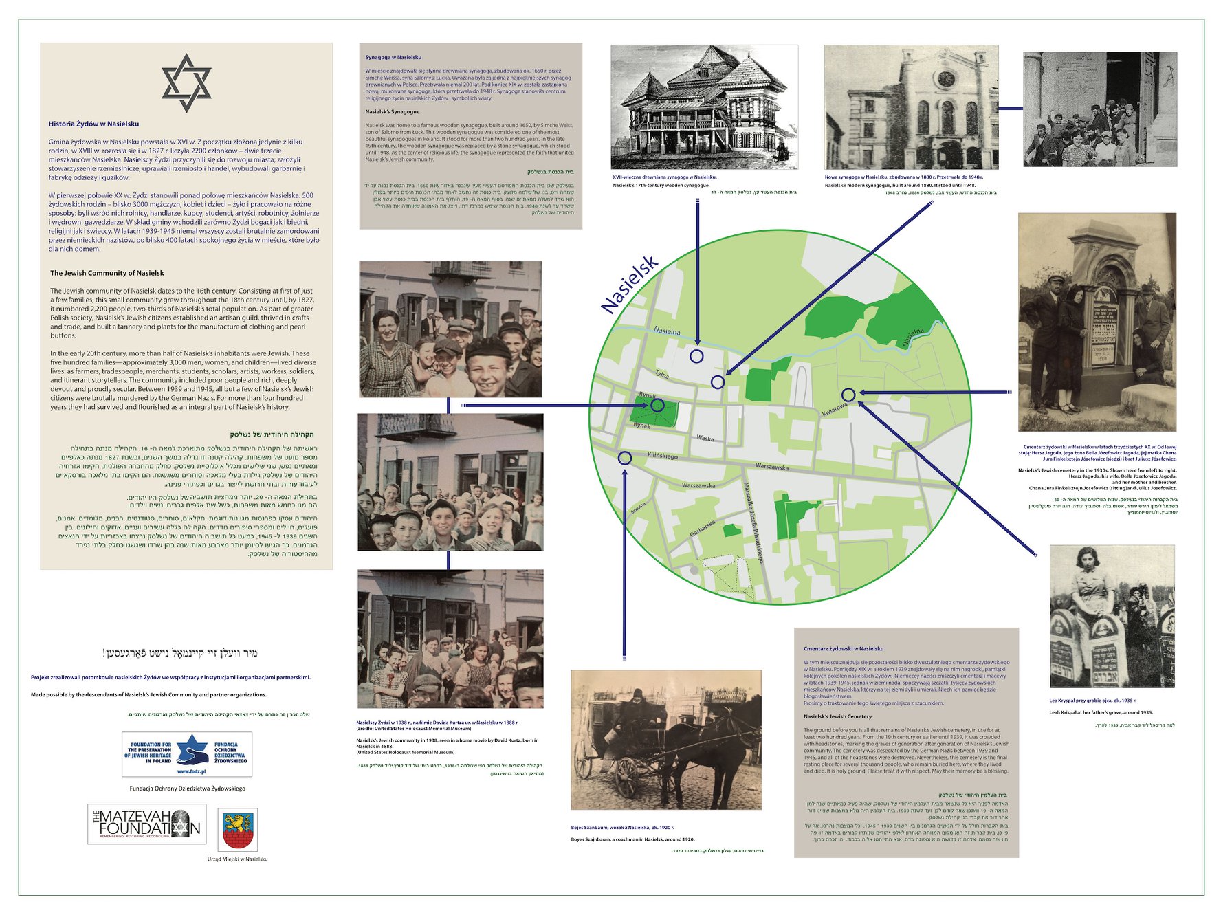
Nasielsk (Poland) Jewish cemetery sign. Image © 2018 The Nasielsk Society for Remembrance and Reconciliation. Click on the image here to see a digital copy of the sign.
Related projects outside western Ukraine: In Serbia, directional signage pointing to the historic Jewish cemetery of Niš was installed at several locations by the local tourism organization in late 2013, marking the site similarly to other cultural heritage sites in the city; the signage was installed in coordination with management and protection of the cemetery by the city administration. In Lithuania, 30 directional road signs were erected in 2020 to point toward Jewish cemeteries and wartime mass graves in and around the city of Šeduva; the signs, which incorporate a Star of David, were installed by the Šeduva Jewish Memorial Fund to highlight historical features of their Lost Shtetl Project. In Romania, a large tri-lingual sign was installed at the old Jewish cemetery in Siret (near the border with Ukraine) in 2013 to provide information and context about the medieval burial site. An excellent information sign was installed at the Nasielsk Jewish cemetery north of Warsaw, Poland in 2018; the sign, in Polish, English, and Hebrew describes the former Jewish community of the town, as well as the cemetery and two synagogues, locating each on a simplified map and illustrating the people and the buildings with prewar photographs.
References
- Taniava Forest Mass Grave Site Preservation – mass grave site project summary page with a photo slideshow, including images of the information sign and the commemorative ceremony in 2009, by the Bolechow Jewish Heritage Society (BJHS)
- Taniava Forest Ceremony – video of the 2009 memorial ceremony at the mass grave site outside of Bolekhiv by the Bolechow Jewish Heritage Society (BJHS)
- History of Bolechow – links to Bolekhiv maps and other family and general history research aids by the Bolechow Jewish Heritage Society (BJHS); see also the Wikipedia page on the Holocaust in Bolekhiv
- Memorial book of the martyrs of Bolechow (Bolekhiv, Bolechów), Ukraine – an online English translation of Sefer ha-zikaron le-kedoshei Bolechow, the Yizkor (memory) book for Bolekhiv’s pre-war Jewish community, coordinated by Alex Sharon, hosted by JewishGen on the website for their Yizkor Book Project; see also an online image set of the original Hebrew and Yiddish version of the book, as “Bolekhiv”, hosted by the New York Public Library Digital Collections
- Bolekhiv – the killing sites and mass graves survey page, including the sites at the Bolekhiv Jewish cemetery and in the forest toward Taniava, on the Holocaust by Bullets web map of Yahad – In Unum